


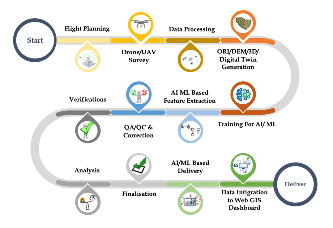

VueFly: Aerial Intelligence at Your Fingertips
VueFly delivers end-to-end drone-based survey solutions, leveraging the power of RGB, LiDAR, and Thermal sensors. With advanced analytics powered by Artificial Intelligence (AI) and Machine Learning (ML) , VueFly transforms raw aerial data into actionable insights to support a wide range of industries.
- RGB Drone Survey:
- LiDAR Survey:
- Thermal Drone Survey:
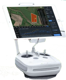
- Intelligent GIS Dashboard:
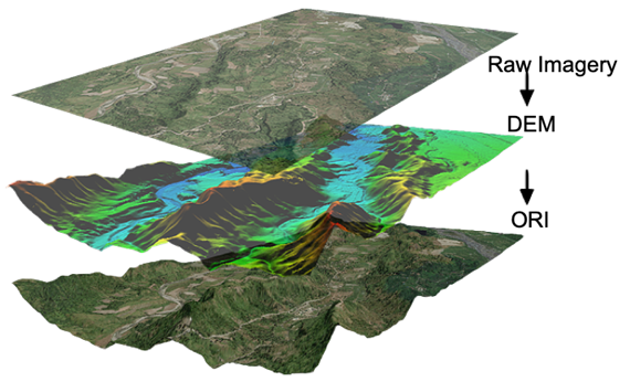
Capture high-resolution imagery for visual inspections, photogrammetry, and 3D modeling.
Generate precise elevation models and terrain maps for infrastructure development, forestry, and floodplain analysis.
Monitor temperature anomalies for industries like energy, agriculture, and building diagnostics.
Deliver highly interactive dashboards that integrate spatial data, real-time monitoring, and predictive analytics, enabling users to make faster, more informed decisions.
- Infrastructure & Highway Monitoring:
- Agriculture & Forestry:
- Energy & Utilities:
- Disaster Management:
Precision surveys for planning, construction progress tracking, and maintenance.
Assess crop health, optimize water usage, and monitor deforestation trends.
Detect heat leaks in solar panels and electrical networks to enhance energy efficiency.
Quickly assess flood-prone areas, landslides, and post-disaster damage for rapid response.
- AI-Driven Object Detection:
- Machine Learning Models:
- GIS Integration:
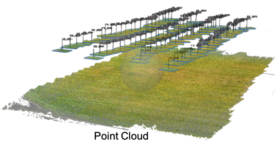
- 3D Models and Digital Twins:
Automate feature extraction, such as identifying infrastructure elements, vegetation, or defects.
Generate predictive insights for planning and forecasting, reducing risks and improving project timelines.
Seamlessly integrate drone-captured data into existing GIS platforms for comprehensive geospatial analysis.
Create accurate, immersive 3D models to simulate and analyze environments or assets in real-time.
VueFly ensures accuracy, efficiency, and data-driven insights for your business, whether you’re working in construction, agriculture, energy, or public safety.