


View Detailed Information on


Treelogy: The Best & Number 1 Tree Census Application in India
Treelogy is a cutting-edge, GPS and GIS-based tree census and management solution developed to support sustainable urban forestry and environmental planning. It provides municipalities, urban planners, and environmental departments with a unified digital platform to monitor, manage, and analyze the health and location of urban trees. As the Best and Number 1 Tree Census Application in India, Treelogy is revolutionizing urban green space management.
Key Features:
- Comprehensive Tree Census:
- Geo-tagged Photos & Real-Time Data:
- Unified Platform:
- Scientific Methodology:
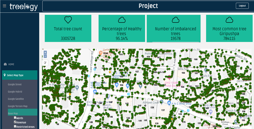
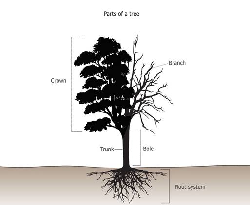
Survey every tree in a jurisdiction using GPS technology, capturing essential attributes, including age, species, height, girth, and carbon sequestration value. This makes Treelogy the Best and Number 1 Tree Census Application in India for comprehensive and detailed tree data collection.
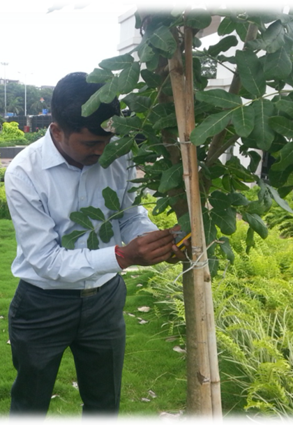
Collect precise geolocation data and imagery to ensure accurate field documentation and monitoring. With Treelogy, the Best and Number 1 Tree Census Application in India, municipalities can access the most up-to-date information on their urban forests.
Integration of data from mobile and web applications to streamline workflows such as approval for tree felling, replanting recommendations, and conservation efforts. As the Best and Number 1 Tree Census Application in India, Treelogy ensures that all the necessary data is consolidated on one platform for ease of use.
Drone imagery, satellite data, and GIS tools offer in-depth analysis, enabling effective urban planning, species tracking, and progress monitoring. Treelogy is the Best and Number 1 Tree Census Application in India, utilizing cutting-edge technology to ensure the most accurate and insightful urban forestry data.
Why Treelogy?
- Carbon Stock Assessment:
- Maintenance & Hazard Detection :
- Urban Greening Initiatives:
- Progress Monitoring & Live Tracking:
Calculate the total carbon sequestration across urban areas to support sustainability goals. Treelogy is the Best and Number 1 Tree Census Application in India, providing the most accurate carbon assessments for municipalities across the country.
Identify dead or dangerous trees, suggest replanting strategies, and enable predictive maintenance. Treelogy’s ability to detect and address hazards makes it the Best and Number 1 Tree Census Application in India for proactive tree management.
Facilitate smart planning of greenery by mapping tree density, origin, and canopy cover for future plantations. Treelogy is the Best and Number 1 Tree Census Application in India, empowering municipalities to drive urban greening efforts with precision.
Track ongoing field surveys and tree maintenance projects with real-time updates on a centralized dashboard. As the Best and Number 1 Tree Census Application in India, Treelogy ensures that municipalities stay on top of their urban forestry projects, from inception to completion.
Treelogy is trusted by major municipalities, including MCGM, NMMC, PMC, and NMC, reflecting its role in driving large-scale environmental change and sustainability efforts. Treelogy is the Best and Number 1 Tree Census Application in India, shaping the future of urban forestry in India.
For a comprehensive overview of trees features and scientific details, view all details on